
Geonova
Provide state of the art surveying accessories!
Showing all 22 resultsSorted by popularity
-
-
-
-
-
-
-
-
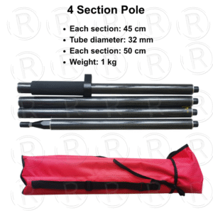
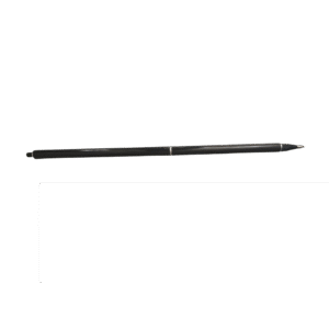
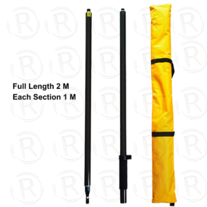
4 Section Carbon Fiber Pole with Full Length 2 M
- Each section: 45 cm
- Tube diameter: 32 mm
- Each section: 50 cm
- Weight: 1 kg
-
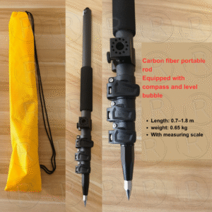
1.8 M Carbon Fiber Pole with Snap Lock
- Length: 0.7-1.8 m
- Weight: 0.65 kg
- With measuring scale
- Equipped with compass and level bubble
-
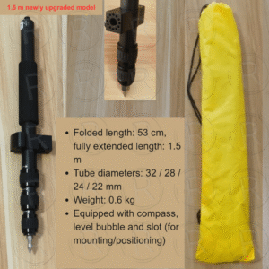
1.5M / 1.8M Aluminium Rotating Telescopic Pole
- Weight: 0.6 kg
- Folded length: 53 cm
- fully extended length: 1.5M
- Tube diameters: 32 / 28 /24/22 mm
- Equipped with compass, level bubble and slot (for mounting/positioning)
-
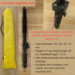
1.8 M Aluminium Rotating Telescopic Pole
- Weight: 0.7 kg;
- folded length: 65¥cm;
- extended height: 1.8 m;·
- Tube diameters: 32/28/24/21mm
- with measuring scale and stop-limitmarkings
Equipped with compass, levelbubble, and slot (card slot/mounting slot)
-
-
-
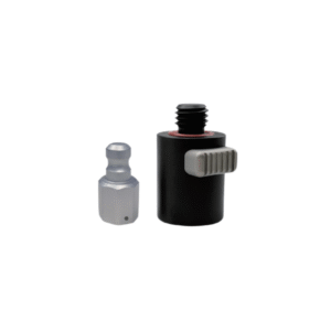
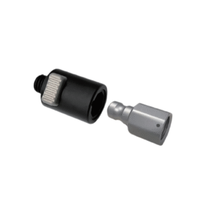
QRA1 RTK QUICK ADAPTER
QRA1 RTK QUICK ADAPTER
- Standard 5/8 x11 Thread
Inner adapter: 19cmx19cmx36.5cm; Outer adapter: 32cmx36.5cmx53cm.
For RTK measuring, the vertical pole height should be increased by 4cm.
Easy-use and high efficiency
Quick attaching and detaching operation can be performed by using one hand -quicker, easier and ‘device-safer’ during the process.
Superior Quality
Made of aluminum alloy. guarantee long-lasting durability and reliable connection.
Optional choice: Zinc alloy.
High Compatibility
Compatible for different brand RTK,centering pole, prism, and so forth.
- Standard 5/8 x11 Thread
-
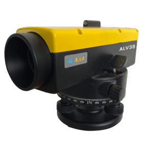
ALV38 Automatic Level
ALV38 Automatic Level
-
High-Magnification Imaging — Features 38× magnification for clear, sharp, and precise readings, ensuring reliable results across all surveying tasks.
-
Dual Compensation System — X-shaped suspension wire combined with air damping delivers stable automatic compensation and effective vibration resistance for accurate leveling.
-
Large Aperture Objective Lens — A 45mm aperture enhances light transmission, making it ideal for performance in low-light or complex outdoor environments.
-
High-Precision Measurement — Achieves a standard deviation of only 1.0mm per kilometer of double-run leveling, meeting high engineering and construction accuracy standards.
-
-
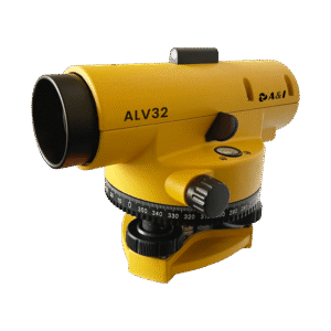
ALV32 Magnetic Damping Automatic Level
ALV32 Magnetic Damping Automatic Level
-
High Precision & Stability: Achieves a standard deviation of 1.5mm per kilometer for double-run leveling, with magnetic damping V-shaped suspension and compensator ensuring exceptional accuracy across engineering surveying, construction, and geological exploration.
-
Powerful Optics: Features 32× magnification with 4.2″ resolution and a wide field of view of 1°20′, with a minimum focusing distance of just 0.4m — enabling clear observation of both near and distant targets.
-
Reliable Compensator & Weatherproofing: Equipped with a magnetic damping automatic compensator for consistent leveling stability, plus an IPX4 waterproof rating to handle various outdoor and challenging field conditions.
-
Versatile Mounting & Wide Working Range: Supports a compensation range of ±15′ for complex measurement scenarios, and is compatible with both M16 and 5/8″ threaded tripods for maximum flexibility on any job site.
-
-
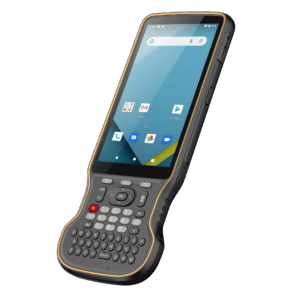
H1 RUGGED KEYBOARD HANDCONTROLLER
H1 RUGGED KEYBOARD HANDCONTROLLER
-
High-Performance & Sunlight-Readable Display: Powered by Qualcomm 662 processor with a 5.5-inch 1080P industrial display at 500 nits brightness, ensuring smooth CAD map display and excellent visibility under direct sunlight.
-
Fast & Reliable Connectivity: Supports dual-band Wi-Fi, 4G global networks, Bluetooth 5.0, and USB 3.0 for rapid large-file transfers, ensuring seamless connection with GNSS receivers and RTK network correction sources.
-
Rugged & Long-Lasting: Weighs only 420g with a high-capacity 9000mAh battery for uninterrupted fieldwork; built to withstand 1.5m drops and rated IP68 waterproof with scratch-resistant Corning Glass for extreme durability.
-
Optimized for Field Operations: Android 12 with a British-style keyboard optimized for surveyor typing habits, multiple shortcut buttons for quick app launching, and Gorilla Glass display — all designed for efficient industry data collection.
-
-
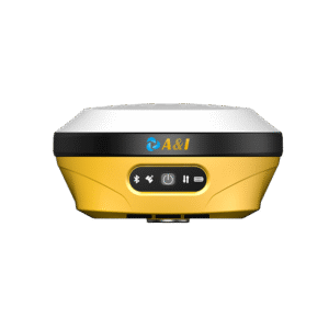
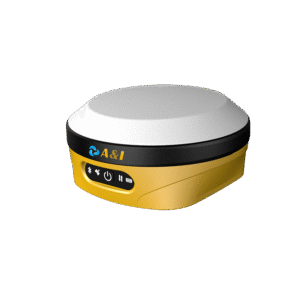
AR15 STAKEOUT RTK
AR15 AR STAKEOUT RTK
-
AR Stakeout: Augmented reality software helps surveyors locate stakeout points easily, reducing the forth-and-back movement of centering poles and improving stakeout efficiency by 50%, especially for beginners.
-
Tilt Measurement: High-precision IMU module enables self-initialization and continuous use during motion, delivering 2cm measurement precision within 60° tilt, completely free from drifting errors.
-
Full Connectivity: Built-in 2W transceiver supports UHF, 4G, LoRa (up to 5km range), WiFi, Bluetooth, and NFC — covering all common communication protocols for maximum field flexibility.
-
Balancing Design: Optimally balances size, weight, endurance, and GNSS antenna performance, integrating GNSS, IMU, and a 2-megapixel camera in one compact and field-ready device.
-
-
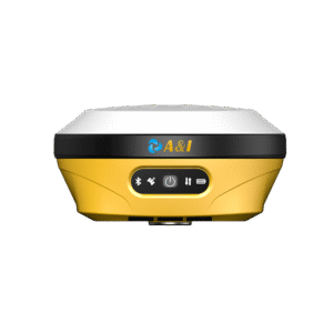
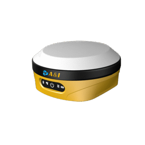
AL16 GEODETIC LASER RTK
AL16 LASER RTK DOUBLE CAMERAS
-
Geodetic-grade integration: A geodetic-grade GNSS receiver combining GNSS, IMU, camera and laser ranging technologies, delivering high-precision non-contact laser measurement with seamless IMU initialization and precise laser calibration.
-
Expanded measurability: Turns previously unmeasurable, unreachable, and hard-to-measure points into safe, surveyable targets — while maintaining full survey accuracy at hazardous locations.
-
AR-powered stake-out: Significantly boosts stake-out efficiency using advanced AR augmented reality technology, showing the exact direction, distance, and position of every stakeout point in real time.
-
Dual-camera guidance: Front and bottom cameras work together to guide the surveyor on where to move and precisely where to place the pole, ensuring fast and accurate field operations.
-
-
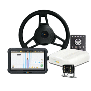
AS10 Autosteering System
AS10 Autosteering System Precision Farming
-
Full GNSS Signal and PPP — Centimeter-level steering accuracy using GNSS RTK corrections
-
Wide Compatibility — Adapts seamlessly to a broad range of agricultural machinery
-
Accurate Steering — High precision pre-descigned, straight-line driving and accurate U-turns
-
All-Terrain Adaptability — Supports complex or irregular field shapes
-
-
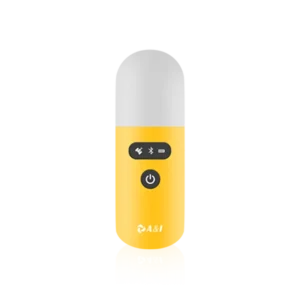
GEOPOD POINT COLLECTOR
GEOPOD
Handheld High-Precision Positioning Collector
- Compact, lightweight handheld high-precision with ergonomic capsule design
- Supports full constellations with multi-frequency capability for global use
- Integrated IMU enables tilt measurement from 0° to 90° with high accuracy (≤1.5 cm up to 60°, ≤2.0 cm near 90°)
- Rugged IP67-rated protection
- Expandable software upgrades
-
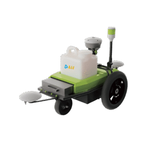
Robotic Linemaker
ARR100 Pre-Marking Robot
Redefining Road Marking Efficiency Through Intelligent Automation
- Centimeter-Level Accuracy — Reliable, repeatable precision marking
- High Productivity — Manual operations at up to 7.2 km/h
- Universal Compatibility — Supports spray devices of various sizes
- All-Terrain Ready — Operates reliably on paved roads, grass, gravel